What is LiDAR and What is it Used For?
LiDAR, which stands for Light Detection and Ranging, is a remote-sensing method that uses light in the form of a pulsed laser to measure ranges (variable distances) between objects.
A LiDAR instrument principally consists of a laser, a scanner, and a specialized GPS receiver.

The light pulses from the LiDAR—combined with other data recorded by the Lidar system—generate precise, three-dimensional information about the shape of various in-range objects, and their surface characteristics.
Two types of LiDAR are topographic (land) and bathymetric (bodies of water). Topographic LiDAR typically uses a near-infrared laser to map the land, while bathymetric LiDAR uses water-penetrating green light to also measure seafloor and riverbed elevations. It is the topographic LiDAR that is currently of interest to the surveillance industry.
Within the surveillance industry, it is the topographic LiDAR systems’ ability to map both natural and manmade environments with accuracy, precision, and flexibility that lends itself to uses in perimeter security, entrances and checkpoint security, and social distancing.
Perimeter Security
LiDAR can monitor fences and detect any unexpected objects within the set boundaries with great accuracy. By providing long-range, centimeter-accurate, and real-time distance measurements of objects in a wide range of lighting conditions, a complete picture of the 3D space can be generated. This also enables the implementation of advanced security techniques like customized digital boundaries, fenceless barriers, or the implementation of a nuanced Perimeter Intrusion Detection (PID) system. On the other hand, a LiDAR-based security system can also monitor an entire property and create a detailed 3D model of the environment to track people and objects.
Secured Entrances and Checkpoints
LiDAR is a great tool to use for tracking people in crowded environments while leaving their identities anonymous. From corporate headquarters to subway stations, LiDAR can effectively keep the overview and count the number of people passing through an entrance, thus enabling effective access control and crowd management.
Social Distancing
The Covid-19 Pandemic has introduced many new terms and practices into our lives, with “social distancing” being one of them. One way to effectively enforce social distancing is to limit the number of people in a particular area through the uses of very accurate people-counting abilities of LiDAR to better implement public health safety measures.
LiDAR is the Future
The benefits of LiDAR include high accuracy and low rate of false alarms, real-time tracking and analysis, seamless integration with cameras and existing infrastructure, and it provides an easy-to-manage, fully-automated security solution.
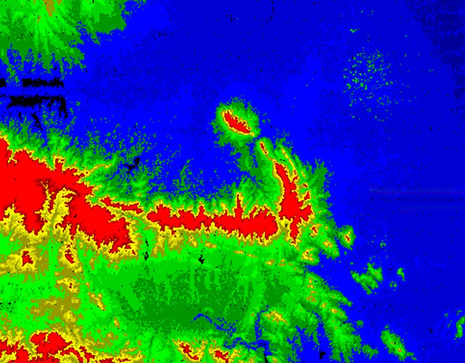
Aerial LiDAR mapping services can be used not only for traditional photogrammetry purposes, but also for forestry, agriculture, digital water conservancy, urban 3D modeling, electricity, and etc..
Feiyan Aerial Remote Sensing Tech Co., Ltd. has been the nation's largest independent geospatial data firm that provides geographic insights to many of the most influential projects in China. An industry leader in advanced mapping technology, Feiyan delivers the leading data processing quality with efficiency, while leveraging the most cutting-edge technologies for aerial data acquisitions, geospatial processing/analytics, and GIS visualization solutions.
- Category:
- Business
- 2 Mar, 2023
- 1285 views
- No comments